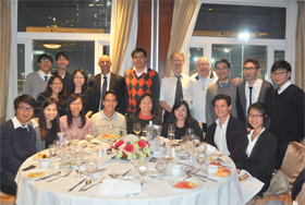
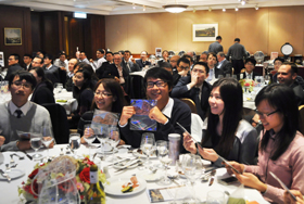
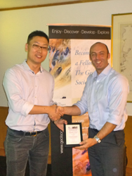
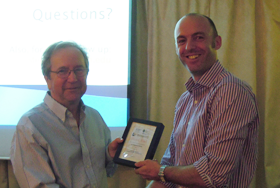
Annual Dinner 2015
Date: 16 January 2015


Joint Technical Seminar: Non-textbook Flowslides in Fine-grained Colluvium
 Date: 2 December 2014
Time: 6.00 pm
Speaker: Professor Oldrich Hungr, University of British Columbia, Canada
Synopsis
The name flowslide applies to a landslide that involves liquefaction due to the
structural collapse of the soil fabric. Flowslides can be extremely damaging, because they involve
sudden failure, high velocity and long runout. They occur during earthquakes, but also often
spontaneously, as a result of over-stress of collapse-susceptible soil.
Much of the existing literature dealing with flowslides relates specifically to known collapsesusceptible
soil types, including loose saturated sand or silt (loess), or extra-sensitive clay.
However, collapsive behavior may occur in a much wider range of soil types. Of particular interest
are flowslides that involve previously-disturbed soils (“colluvium”).
This lecture presented several cases of major, fatal flowslides that occurred in colluvium formed by previous slow, ductile
landsliding. It appears that softening of the disturbed cohesive soil can dramatically change its
failure behavior. Thus, assumptions of ductile failure in a given material, even if backed by
previous site experience, may become disastrously incorrect. The most common soils involved in
these dangerous flowslides are low to moderate plasticity silty clays and silts. The provenance of
the examples is Canada, Western USA, Europe and South-East Asia.
About the Speaker
Professor Oldrich Hungr is a Professor of Geological Engineering at the University of British
Columbia in Canada. He is an eminent engineering geologist and is internationally recognized for
his research in landslide hazards. He has contributed significantly towards the modelling of
landslide behaviour with emphasis on debris dynamics, landslide hazards mapping, quantitative
hazard and risk assessment and design of remedial and protective measures. He is one of the
three members of the current Slope Safety Technical Review Board to advise the HKSAR
Government on technical aspects of slope safety.
Downloads
Flyer
Presentation
Evening Seminar: Managing very large landslides
 Date: 28th November 2014
Time: 6.30 pm – 7:30 pm
Venue: Lecture Theatre 10 (LT-10), 4/F Academic 1, City University of Hong Kong
Speaker: Prof. David Petley
Synopsis
Landslides in high mountain areas, such as the Himalayas and the Southern Alps of New Zealand, have the potential to cause very high levels of damage. In most cases they are so large that it is impossible to mitigate them, such that other approaches need to be developed to manage the hazard.
 This talk focused on three case studies.
- The first explored the Attabad landslide, which in 2010 blocked the Hunza valley in Northern Pakistan, threatening 25,000 people with a dam burst flood. The presenter was involved in a six month long project to manage the risk as the water level approached the overtopping point, which included the setting up of warning systems and the relocation of large numbers of people.
- The second explored the Gayari rock avalanche in Siachen, Pakistan, which killed 142 soldiers based at an army camp. The author was involved in a programme of work to find and recover the remains of the victims, all of whom were buried 25 m below rock and ice debris from the landslide.
- The third examined the threats posed by the Utiku landslide in New Zealand, which is a very large but slow moving slide that threatens a railway and a strategic highway.
In each case the talk examined the threats that the landslides posed and the lessons that can be learnt from their management.
 About the Speaker
Prof. Petley is Pro-Vice Chancellor at the University of East Anglia, and was until recently the Dean of Research and Global Engagement at the University of Durham. He is an active and authoritative researcher in his field and an experienced manager of research. He also writes one of the most informative and visited blogs on landslide matters: http://blogs.agu.org/landslideblog/
He graduated with a degree in Geography from King's College London and a PhD in Earth Science at UCL. His first academic post was a lectureship in Environmental Studies at the University of Sunderland, which was followed by a lectureship in Engineering Geology at the University of Portsmouth.
He joined the University of Durham as a lecturer in Physical Geography in 2000 and was promoted to a readership in 2004. In 2006 he became the Wilson Chair in Hazard and Risk and the Deputy Head of the Faculty of Social Sciences and Health, with responsibility for research and enterprise. For the next two years Prof Petley was Executive Director of the Institute of Hazard, Risk and Resilience before becoming Dean of Research and Global Engagement in May 2012. Prof Petley managed the Durham submission for REF2014 as well as leading on the development of a new University Research Strategy and overseeing the development and implementation of the internationalisation strategy at Durham.
Prof Petley’s research focuses on landslides, especially in high mountain areas in low income countries. In particular, he is interested in the use of novel combinations of field monitoring and laboratory testing to understand the internal mechanisms of mass movements. He also maintains a database of landslides that cause loss of life around the world.
Downloads
Flyer
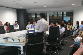
Sharing Session: Towards Chartership
 Date: 17 November 2014
Time: 6.30 pm – 8.00 pm
Synopsis
The Geological Society of London is the recognised UK professional body for Geoscientists and was established with the aim of providing lifelong professional support to geoscientists and assuring high professional standards for the benefit of society. It awards the title of Chartered Geologist (CGeol) to competent professionals and is also licensed by the Science Council to award the title of Chartered Scientist (CSci). In recent years there has been increased recognition of the CGeol qualification in Hong Kong and it now the de facto professional standard by which local geologists working in the construction sector are measured.
 This sharing session was aimed at early career geologists, providing an overview of the Chartership system, what it is, why it’s worth pursuing and what’s required in order to obtain recognition as a CGeol. In addition to a general overview of these matters, we also invited a number of experienced scrutineers and recent successful CGeol candidates to share their views and experience on the chartership process during a relaxed, informal discussion session. This session directed attendees to the right pathway towards chartership.

Programme
- Brief history of CGeol
- Motives for getting chartered
- Eligibility criteria for CGeol
- Competency requirements for CGeol
- Getting the right experience
- Mature Candidates Route for those with >20-years’ experience
- Introduction to CSci and EurGeol
- Open Discussion with the scrutineers and fellows who achieved CGeol recently
Downloads
Flyer
Slides
 Career Talk
Date: Friday 30 October 2014
Time: 18:30 - 20:00
Venue: Room 105, James Hsioung Lee Science Building, The University of Hong Kong
The GSL Hong Kong Regional Group held a Career Talk to the students in the University of Hong Kong.
Photos
Structural Controls and Contributions to Orogenic Lode-Gold Deposits;
Including a Case Study of the Young-Davidson Mine, Southern Abitibi Subprovince of Canada
 Date: 4 June 2014
Speaker: Dr. Jason J. Zhang
“If a rock is deformed, its geometry before deformation must have been different from its current geometry. If we want to understand the relationships at a certain stage in the geological history, it is necessary to understand the geometry at that time”.
A structural thinking is always the first priority in studying the mineral deposits of a deformed region.
 As one of the ‘richest’ areas of the world, the Neoarchean (~2.7 billion years) southern Abitibi greenstone belt (subprovince) is well known for its lithological complexity, polyphase deformation, extensive hydrothermal alteration, and spatial association with world-class orogenic gold deposits. Within the subprovince, intrusion-related, in particular syenite-hosted gold deposits represent a significant type that is poorly understood. Whether the gold mineralization is genetically linked to the syenite intrusions (as in a magmatic model) or structurally associated with the subsequent crustal-scale shear zones remains very controversial.
 This talk presented the first-hand surface and underground mapping results, based on which we identify multiple generations of auriferous vein arrays. Combined with petrologic, petrographic and isotopic geochronologic data, we attempted to unravel their spatial and temporal relations to the regional polyphase deformational events and the major timing of gold mineralization.
Outputs of this research will help understand other syenite- or small felsic intrusion-hosted gold deposits and guide gold explorations throughout the Abitibi subprovince and other greenstone belts worldwide.
Downloads
Flyer
Site Visit to Ninepins
Date: 21 September 2014
The Ninepin Group (Kwo Chau Islands) forms one of the Geoparks in Hong Kong and includes South Ninepin Island, North Ninepin Island and East Ninepin Island, along with several small rock islands.
Amongst the group, the extremely uniform hexagonal rock columns at the North Ninepin are one of the most spectacular landforms and attract thousands of visitors every year.
 These columnar jointed volcanic rocks could date back to the age of about 140 million years ago. These rock islands were believed to be formed by a major catastrophic volcanic eruption during which vast amount of volcanic ash were erupted and resulted in building up of thick layers of tuff. When the eruption came to the end, the tuff contracted during cooling. The cooling joints within the tuff formed vertically and gradually became the magnificent rugged landscape we see today.
Dr. Rod Sewell of the Hong Kong Geological Survey kindly agreed to join this trip in order to provide an overview of the geological history of the Ninepins and the supervolcano that led to their existence.
Downloads
Flyer
See more pictures from our visit.
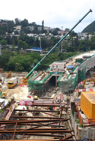
Site Visit to Tuen Mun Chak Lap Kok Link
Date: 20 September 2014
 The Group visited the Tuen Mun – Chek Lap Kok Link (TM-CLKL), a proposed strategic road link between North West New Territories, North Lantau, the proposed Hong Kong - Zhuhai - Macao Bridge Hong Kong Boundary Crossing Facilites (HKBCF) and the Hong Kong International Airport (HKIA) at Chek Lap Kok on 20 September 2014.
TM-CLKL – Northern Connection Sub-sea Tunnel Section (Contract No. HY/2012/08) commenced on 5 August 2013. The Contract mainly comprises a dual 2-lane sub-sea tunnel approximately 5 km long between Tuen Mun and the BCF, reclamation to form land of approximately 16.5 hectares for the tunnel landfall at Tuen Mun and associated civil, structural, building, geotechnical, marine, water supplies, drainage, sewerage, landscaping works and reprovisioning works of affected existing facilities.
 The on-going construction activities include vibrocompaction, reclamation, D-wall excavation, steel cage installation, shaft excavation, box culvert bored pile construction, GI for post ground treatment and GI for interface coring.
Downloads
Flyer
See more pictures from our visit
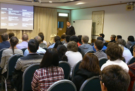
Advances in Terrain Mapping and Analysis for Landslide Hazard Assessment
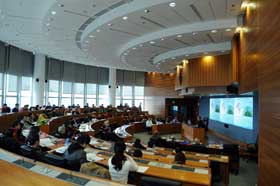 Date: 22 February 2014
The Hong Kong Regional Group held its second one-day conference, following on from the event on Engineering Geology in Geotechnical Risk Management held as part of the bicentennial celebrations in 2007. The 2014 conference took up the theme ‘Advances in Terrain Mapping and Analysis for Landslide Hazard Assessment’, partly as a means of sharing the collective experience and knowledge gained through the various natural terrain hazard assessments conducted in Hong Kong and geohazard assessments conducted elsewhere in the region, and also as a means of funding a trip to Hong Kong by this year’s Glossop Medal recipient Prof. Jim Griffith, who repeated his Glossop Lecture in the week preceding the conference and also delivered the keynote address at the conference itself.
Overall the conference was a great success, primarily as a result of the hard work of the organising committee led by Dick Martin and also thanks to the high quality of the thirteen papers submitted, twelve of which were presented on the day and several of which can be downloaded below. Over 100 local practitioners and academics attended the event, hosted by the Department of Land Surveying and Geo-Infomatics at the Hong Kong Polytechnic University, and the feedback received on both the presentations given and conference proceedings was extremely positive.
Stuart Millis, Chair, Hong Kong Regional Group
Downloads
Images from the conference
An Application of Quantitative Geomorphology in Landslide Hazard Assessment - Angel Ng
Evolution of NTHA Strategy in Hong Kong - Ng, Ho & Roberts
Terrain Evaluation Mapping for Landslide Hazard Assessment on North-Eastern Hong Kong Island - Dias, Williamson & Chu
 Hong Kong Regional Group AGM
Date: 18 February 2014
The Hong Kong Regional Group of the Geological Society of London held its Annual General Meeting on 18 February. The group Chair's Report can be viewed below.
HKRG Chair's Report, 2013-14
 A Perspective on the Role of Geophysics
Date: 12 February 2014
Drawing on a long career as a professional geophysicist, Frank Collar gave a talk offering a unique insight into the role of geophysics in water, mining and oil and gas exploration.
Event flyer
Images of the evening
Fossil-Hunting in Australia

Date: 8 January 2014
Dr Susan Turner and Dr Tony Thulborn gave presentations on their work in palaeontology and palaeobiology.
Event flyer
Images of the event
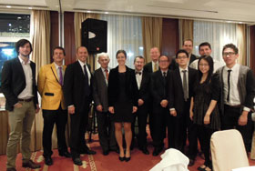 Annual Dinner
Date: 22 November 2013
The Geological Society of London celebrated the 12th Anniversary of the founding of the Hong Kong Regional Group. Our Guest of Honour was David Shilston (President of the Society) who gave a talk entitled “LUSI: the Geology and Engineering of a Mud Volcano disaster in Java”. The talk described LUSI (Lumpur Sidoarjo), its evolution, its impact, and what can be said about its future development.
Images from the evening
Careers Evening
Date: 20 November 2013
The Hong Kong Regional Group hosted a Careers Evening on Wednesday 20 November 2013. It was an opportunity to learn about the Geological Society and explore what Geoscientists do.
Images from the evening
Empiricism, Theory and Problem Solving in Rock Engineering
Date: 24 October 2013
Dr Nick Barton of Nick Barton & Associates, delivered a lecture titled 'Empiricism, Theory and Problem Solving in Rock Engineering' on 24 October 2013.
Lecture slides
Images from the Lecture
Technical Site Visit: Kwun Tong Line Extension - MTRC Contract No. 1001
Date: 31 August 2013
The site visit was a free trip to see the Kwun Tong Line Extension (KTE). KTE is an extension of the existing MTR Kwun Tong Line from Yau Ma Tei to Whampoa. The construction works began in May 2011 for completion in 2015.
Lecture slides
Images from Kwun Tong Line Extension
 Inner Mongolia Research Project: Dinosaur Palaeontology in the Gobi Desert
Date: 7 August 2013
Dr Michael Pittman (University of Hong Kong) gave a talk introducing attendees to the discoveries made by the Inner Mongolia Research Project.
Event flyer
Images of the event
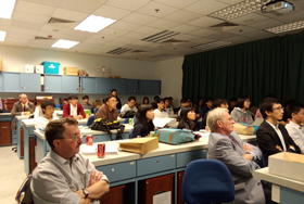
XRL822 Technical Site Visit: Pat Hueng Site
Date: 20 July 2013
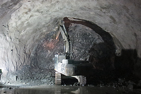 The Hong Kong Regional Group organised a free site visit to the C822 Technical Site on 20 July 2013. During the site visit, attendees were able to visit the Pat Heung site which currently involves the construction of the ventilation building, the main tunnel excavation and the construction of the permanent tunnel lining.
Lecture slides
Images from the site visit
Technical Talk: From geological maps to 3D and 4D models.
Date: 18 July 2013
 Dr Diarmand Campbell presented a technical talk titled "From geological maps to 3D and 4D models - transforming the delivery and relevance of geological knowledge for practitioners".
Geological Survey Organisations (GSOs) are increasingly replacing geological map outputs, by highly visual,variably parameterised 3D, and 4D, models (deterministic and stochastic). Benefitting from improving software, workflows, and visualisation tools, these deliver geological data and knowledge to practitioners engaged in a range of engineering and environmental decision-making.
 The British Geological Survey has embraced the migration from 2D to 3D and 4D in developing a National Geological Model of the UK. This aims to be an accurate, multi-scalar, 3D geospatial model depicting the subsurface rocks and sediments. It draws on vast amounts of borehole and other subsurface data and knowledge (e.g. 2.5 million borehole records), and existing local and regional 3D models.
Flyer
Lecture slides
Technical Talk: Cost Implications of Underground Space Characteristics
Date: 11 June 2013
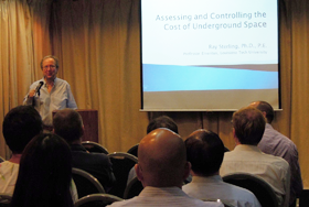 On 11 June 2013 the Hong Kong Regional Group hosted a technical talk on "Assessing and Controlling the Cost of Underground Space". Dr Ray Sterling, Ph.D., P.E. Professor Emeritus, Louisiana Tech University delivered the lecture.
This lecture explored the project constraints and design issues that affect the construction cost of underground space together with an examination of how indirect/social costs, operational costs and land value changes can impact the overall life cycle cost equation.
A number of worldwide examples were used to illustrate the talk and to point out some of the challenges in making underground space use a long-term success.
Lecture slides
Flyer
Technical Site Visit: South Island Line (East) - MTR Contract 902
Date: 8 June 2013
 On 8 June 2013 the Hong Kong Regional Group hosted a site visit of the South Island Line (East) - MTR Contract 902. Contract 902 forms part of MTRC's South Island Line (East) which is a medium-capacity railway connecting the Southern District of Hong Kong to the existing Admiralty Station.
Contract 902 includes the design and construction of Nam Fung Tunnel and two ventilation buildings. The drill-and-blast tunnel is approximately 3.2km long extending from Admiralty Station in the north to the Nam Fung Ventilation Building in the south. The Hong Kong Park Ventilation Shaft is an 80m deep, 30m diameter elliptical shaped shaft under construction in a densely populated urban environment on the north side of Hong Kong Island.
Works near Nam Fung Portal at the southern end, include the Nam Fung Ventilation Building pipe pile ELS together with an enclosed railway transition box structure including site formation works, bored piling works, and shaft ELS construction works.
Images from the visit
Flyer
Life in Extreme Environments and its Application to the Habitability of the Universe
Date: 13 May 2013
 Dr Y. L. Li from the University of Hong Kong gave a lecture on the survival of extremophiles in extreme environments and what this means for life in the Universe. Extremophiles thrive in ice, boiling water, acid, the water core of nuclear reactors, salt crystals, and toxic waste and in a range of extreme habitats that were previously thought to be inhospitable for life. Knowledge of extremophilic habitats expands the number and types of extraterrestrial locations
that may be targeted for searching a second origin of life.
Life in Extreme Environment - Lecture slides
Images from the event
Albania - Kosovo Highway
Date: 8 April 2013
 Mr Nick Koor from the University of Portsmouth gave a talk on ”Albania - Kosova Highway” on 8 April 2013 in Hong Kong. The Albania - Kosova Highway is a new transportation link which will ultimately link the Adriatic Sea at Durres to the Pan-European corridor in Serbia. The route takes the road through the stunning scenery of the “Albanian Alps” and highly complex active geology.
The Albanian part of the road was opened in 2010. Nick was employed as a technical advisor for a series of significant slope failures which occurred during the construction of part of the new highway. His talk focused on these failures highlighting the geological issues, such as the inadequacy of the site investigation.
Albania - Kosovo Highway