Product has been added to the basket

Back to bedrock!


North sheet of the 5th edition

BGS is poised to published a new small-scale map of the United Kingdom as two sheets: Bedrock Geology UK North & Bedrock Geology UK South; each with its own descriptive booklet, writes Alan Smith.

Geoscientist 18.3 March 2008


The British Geological Survey has created new 1:625 000 scale Bedrock map for the UK and the innovative UK Stratigraphical Chart, in collaboration with the Geological Society's Stratigraphy Commission.

The 1:625 000 scale map (successor to the beloved ‘10-mile’ map) is one of BGS’s most popular publications. Since it was first published in 1948 the two sheets have been familiar to students and academics, public bodies and commercial companies alike.

This fifth edition is completely new, but will still be familiar as it aims for a similar level of detail to the old 10-mile sheets. However, some parts are simplified (e.g., Jurassic strata in England), and others more detailed (e.g., the Chalk in England and Wales and the ‘Precambrian’ of the Scottish NW Highlands and Grampians).

The new maps are printed on larger sheets of paper and for the first time include all of Northern Ireland. There is an 80km overlap between them, so that all of the Lake District is present on the northern sheet and all of the North Yorkshire Moors on the southern one. With the additional space there is room for cross-sections showing the structure to about 15km. If the northern section is removed or folded back the two sheets may still be mounted together as the title panel information, masked at top right by the overlap, is repeated at bottom left.

The topographic base-map has been provided by Harper Collins, but the Ordnance Survey’s National Grid is retained for easy reference, as is the index of published 1:50 000 geological maps sheets. Both sheets have an accompanying descriptive booklet. Attractively produced in full colour, these contain a useful introduction for non-geologists. Each geological period in the booklet is then described in a separate chapter with thumbnail sketch maps, photographs and illustrations. As to geological content, a large number of the component 1:50 000 scale geological maps have been revised or resurveyed since the 1979 third edition was published. All this new information and improved understanding is reflected in the new map.
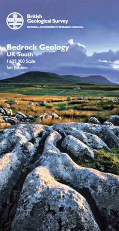
South sheet

How it was done


This new edition has been created by generalisation of the latest 1:50 000 scale digital geological data for England, Wales and Scotland, and the 1:250 000 scale data for Northern Ireland. The data were first interrogated to provide digital selections of associated rock units, of all ranks, based on their stratigraphic correlations, hierarchies and lithologies in order to rationalise the multitude of beds, members, formations and groups, and the intrusive and extrusive rocks. Once established, the generalised digital selections were displayed in colour in order for a cartographic generalisation to be carried out. This cartographic generalisation was informed by the rock classification, emphasising important small units where necessary. The map is consistently more spatially accurate than previous editions, with more intricate linework possible. Many more faults are shown, including thrusts, and the classification and depiction of dykes is improved.

The most obvious change on the new edition is in the key and the system for labelling geological units. The single column of boxes seen on earlier editions is replaced by a main column on the left, supplemented by additional columns to the right, where necessary, to show regional variation. This allows some of the geological complexity (best illustrated by BGS’s new Stratigraphical Chart of the United Kingdom – see below) to be seen in simplified form. The single sequence of numbers from 1 to 115, first used to unify the geology of the UK on the third edition, is here replaced by a system of letters and numbers. Again this echoes the first edition, where sedimentary units in England and Wales were labelled with letters.

Rather than reinstate these, as they did not include the ‘Precambrian’, an existing alternative was adopted and modified. Thus the initial letter of each geological period is used as the primary identifier. Ordovician rocks are labelled with an ‘O’, Carboniferous with a ‘C’ and duplication is avoided by using established alternatives: ‘E’ for Cambrian and ‘K’ for Cretaceous. Within each period, units are numbered sequentially upwards, based on the chronostratigraphy or lithostratigraphy, whichever is most practicable, so that rocks of the same age, or approximately equivalent, have the same number. A further benefit of this scheme is its flexibility; in future editions of the map it will easy to revise the stratigraphy by adding or removing units as appropriate.


  • The digital vector data for the earlier fourth edition Bedrock (and first edition Quaternary) are both available free of charge for non-commercial uses from the BGS website at: www.bgs.ac.uk/products/digitalmaps/data_625k.html
  • It is planned to make the new 5th edition Bedrock geological data similarly available as soon as possible. The new maps (flat or folded) and booklets are available separately from BGS, price £10 each or £15 for a map and accompanying booklet package; and the folded map and booklet come in a plastic wallet.
  • Visit www.geologyshop.com E: [email protected]
Strat Chart

Strat struts its stuff


Geoscientist 18.3 March 2008


New Stratigraphical Charts for northern and southern Britain, produced by BGS in collaboration with the Stratigraphy Commission, are now out, writes Colin Waters.


The two charts present, in total, 28 lithostratigraphical columns for onshore regions of England, Scotland, Wales, Northern Ireland, the Isle of Man and offshore regions. The onshore regions broadly correspond to the extents of the BGS Regional Guide Series and the offshore equate to either single or combined UK Offshore Regional Report Series areas. They are intended to complement the new 1:625 000-scale bedrock geological maps and provide a stimulating teaching aid and reference chart for professional geoscientists.

The concept for the charts evolved from the Stratigraphical Table of Germany (Menning & German Stratigraphic Commission, 2002). As with the German chart, the aim is to present regional idealised lithostratigraphical columns, scaled against geological time. The time-scale used, the BGS Geological Time Chart 2007, is based upon the International Commission on Stratigraphy (ICS) A Geologic Time Scale 2004 (Gradstein et al., 2004). Modifications have included the presentation of the British Carboniferous and Ordovician regional stage nomenclatures, in addition to the international names. Also, "Quaternary" and "Tertiary" (informal term) have been reinstated, the former being shown as a System (base at 2.6Ma), following decisions approved by the International Union of Quaternary Research (INQUA) and ICS in 2007.

Presenting the stratigraphical columns against a timescale, rather than the traditional approach of displaying thickness, provides an opportunity to visualise (perhaps for the first time) the duration of units, and especially, the great amount of geological time represented by gaps in the succession. To maximise detail, it has been necessary to have several scales: most of the Phanerozoic is shown at 1cm:10Ma, while the Quaternary and the ‘Precambrian’ are shown at larger and smaller scales respectively.

Naming of parts


The stratigraphical nomenclature used on the charts is that formally defined in the BGS Stratigraphical Framework Reports (www.bgs.ac.uk/reference/reports/home.html) and the BGS Lexicon of Named Rock Units (www.bgs.ac.uk/lexicon/lexicon_intro.htms). The columns typically present group and formation nomenclatures. It has not been possible to present all the multitude of approved lithostratigraphical terms on the charts. The authors have decided to present either the most representative or most widely known successions for each region. Lithostratigraphical units are coloured according to the dominant environment of deposition for that unit. This demonstrates the lateral extent of depositional environments across Britain and how environments have evolved with time. Symbols are used to denote key characteristics of the units, such as the presence of significant coal or evaporite deposits. Although designed to present the sedimentary and volcanic successions, the charts also display the extent (spatial and temporal) of the main intrusive igneous phases and tectonic events.

  • Unfolded charts are available from BGS, price £10; visit www.geologyshop.com. E: email:[email protected]. Stratigraphical chart of the UK: Southern Britain 1st Edition ISBN 978-0-7518-3561-8 and Stratigraphical chart of the UK: Northern Britain 1st Edition ISBN 978-0-7518-3562-5.

References

  • Gradstein, F M, Ogg, J G, Smith, A G, et al. 2004. A Geologic Time Scale: 2004. Cambridge University Press, 500pp.
  • Menning, M and German Stratigraphic Commission 2002. A geologic time scale 2002, in: German Stratigraphic Commission (ed,), Stratigraphic Table of Germany 2002.

Acknowledgments - credits

  • All material © BGS/NERC Reproduced by permission, ref. IPR/98-61C. Cover photos on new maps, Copyright Joe Cornish.