 Geoscientist 20.02 February 2010
The BGS is leaping ahead in the release of free online materials with the launch of OpenGeoscience (
www.bgs.ac.uk/opengeoscience). This is a new free web service, where users are able to view high resolution geological maps, download photographs and other geoscience information. People are free to use this information in any way they wish in support of their teaching, research and other non-commercial activities.
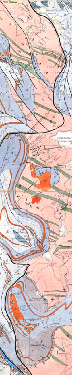
In its first release, OpenGeoscience provides the BGS Digital Geological Map of Great Britain at the 1:50,000 scale (DiGMapGB-50) for free viewing and access via a web map service (WMS). This will include availability of the map through the OneGeology (www.onegeology.org) portal. DiGMapGB-50 represents the culmination of 175 years of geological mapping in Great Britain, and its free release via OpenGeoscience is a major step forward in increasing access and use.
Not only this, but it also includes a new photographic database, GeoScenic, with almost 50,000 high quality photos at high (1000-by-1000-pixel) resolution. There are a range of special images collections, such as, “Best of BGS images”, the British Science Association’s major historical collection of Earth science field photographs and Dr R Kidston’s Carboniferous plants (scanned from original glass plates).
Professor Paul Smith, Head Geography, Earth & Environmental Sciences at Birmingham University, says: “The amount of online material provided for educational purposes by BGS has increased very considerably over a short timescale, and has the capacity to transform the way in which geosciences are taught in universities.”
OpenGeoscience is an acceleration of a process which has already seen an opening up of online provision of BGS digital materials. The service will continue to be enhanced during 2010, with further significant releases of digital materials – for example, scanned borehole-records information for viewing. Also included will be a new range of INSPIRE -compliant data discovery (INSPIRE is an EU directive that promotes sharing of spatial environmental information among public sector organisations) and view services of BGS datasets starting with the layers currently available within the BGS GeoIndex application www.bgs.ac.uk/geoindex.
Professor John Ludden, BGS Director, says: “OpenGeoscience is an exciting initiative that will enable the BGS to meet its objective of providing modern geoscience knowledge and services for the UK’s national good. Through OpenGeoscience the BGS will show the world the wealth of information it holds.”
OpenGeoscience complements and enhances an already strong range of services and delivery routes for BGS geoscience information. For example, a range BGS digital materials is already available to the HE sector for download through the EDINA Digimap service (www.edina.ac.uk/digimap) in support of teaching and research. In addition to this, BGS also produces a free bespoke package, GeoScholar, which offers a wide range of digital teaching materials about classical areas of UK geology Britain, targeted at HE institutions.
Re-use of BGS materials in the business sector continues to be served through a range of highly successful fee-paying services, such as, BGS GeoRecords and GeoReports, and Digital Data Licensing services available from the BGS and commercial resellers.
* Dr R Keith Westhead is Head of Information Delivery, British Geological Survey, and is based in Murchison House, Edinburgh.